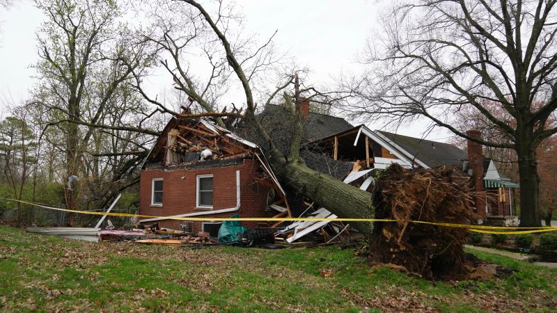
A line of strong storms produced more than 200 reports of severe weather from the Ohio River Valley to the Ozarks through 11 p.m. E.T. Wednesday, according to the Storm Prediction Center. There were 19 reports of tornadoes scattered across Arkansas, Illinois, Kentucky and Missouri. Numbers could increase substantially from overnight activity.
The SPC reports four people were injured from a tornado that damaged multiple structures in the Gage community in Kentucky. In Advance, eastern Missouri, a tornado destroyed a home. In a nearby town, one person was found dead, though authorities cannot confirm whether that was linked to the storms.
The strength and total number of tornadoes will not be known until local National Weather Service offices conduct damage surveys, which may take several days, hampered by the threat of more storms in some of the same areas.
The storms also produced 117 reports of wind damage, bringing down numerous trees and powerlines and damaging buildings across nine states. Two people were injured in Hartsburg, Illinois, when two semi tricks flipped on Highway 155. In Mill Grove, Indiana, one person was injured when a barn was blown into a house.
Some of the highest gusts reported include:
Eaton, Indiana: 100 mph
Orland, Indiana: 98 mph
Latham, Illinois: 90 mph
Lapel, Indiana: 87 mph
Homecroft, Indiana: 80 mph
There were 84 reports of hail, including 15 of hail larger than 2 inches in diameter. Some of the larger amounts include:
Baseball-sized hail in Ashland City, Tennessee, which blew out windshields, and similar-sized hail in Sandy Springs, Mississippi and Forrest City, Arkansas. Tennis ball-sized hail was reported in South Fork, Missouri.
Storms containing tornadoes continue to move eastward across the Ohio and Tennessee River Valleys, with tornado watches that will continue until 6 a.m. E.T.
The system producing the storms will effectively stall in many of the same areas and there is a level 3 out of 5 risk of more severe weather Thursday from the mid-Atlantic southwestward to Texas, impacting 79 million people. The region with the highest risk impacts 4 million people and includes Little Rock and Memphis.
One of the biggest threats these storms pose, beside tornadoes and hail, is torrential rain that could lead to catastrophic flooding.
Nearly 39 million people are under flood watches, from Ohio to extreme northeast Texas.
In the wake of Wednesday’s storms, anywhere from 2 to 4 inches has fallen. The threatened rain over the next few days could lead to widespread flash flooding that the NWS categorized as “an event that happens once in a generation to once in a lifetime producing historic rainfall totals and impacts.”

